
Michelle Harris
Department of Geography
University of South Carolina
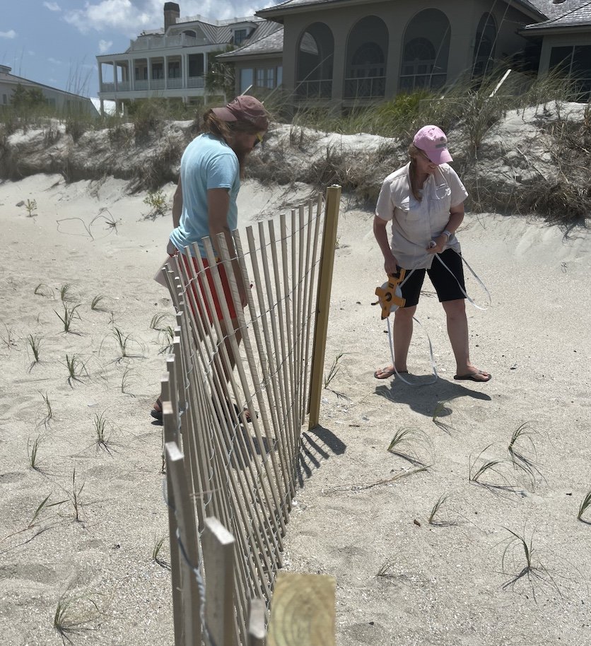
Dr. Peter Tereszkiewicz (WINDlab alum) and Michelle Harris taking sand fence measurements. (Courtesy of M. Harris)
Michelle’s Story
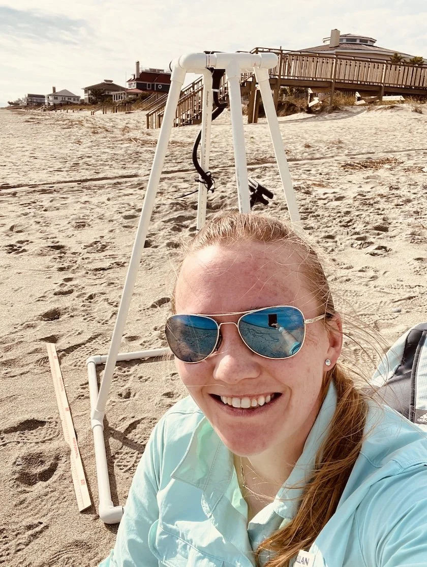
Michelle Harris preparing to start a vegetation survey using a modified PVC quadrat for dune vegetation. (Courtesy M. Harris)
Michelle Harris is a doctoral candidate in the Department of Geography and member of the Wind-sediment Interactions and Nearshore Dynamics Lab (WINDlab) led by Dr. Jean Taylor Ellis, Professor of Geography, University of South Carolina. Her research focuses on managed beach-dune systems in South Carolina and post-storm response and recovery at the meso-scale. In line with the mission of the WINDlab, she enjoys adopting diverse scientific methods (notably fieldwork and remote sensing (e.g., LiDAR)) in her research and aims to relay meaningful results to local stakeholders and community members. More recently she is adopting qualitative research methods to expand her experience in human perception to coastal environments. Michelle was a 2020 John A. Knauss Marine Policy Fellow and completed her M.S. at USC. Her B.S. in geography is from Sam Houston State University. When she is not found storm-chasing and conducting fieldwork, you can find her training her new dog or listening to Mumford and Sons.
Michelle’s Research
Part of Michelle’s dissertation research is focused on assessing the efficacy of dune management strategies in Debordieu, SC. Debordieu was nourished in early 2022 and as part of the nourishment, dunes were constructed with sand fencing and vegetation. Despite this being an increasingly common practice along the East Coast, gaps in the literature still exist with respect to optimal construction metrics for optimizing dune growth and resilience. The goal of this study was to conduct topographic surveys using a Leica Terrestrial Laser Scanner (TLS) to assess topographic change across three field sites that were constructed with different metrics: one with sand fences and dune vegetation installed on a nourished sand dune; a second site with fences and vegetation installed on a flat backshore; and a third “control” site that had not been managed since 2015. In addition, vegetation surveys were completed using a 0.8 m2 quadrat and photos to assess species presence and abundance per site. The study length was established for one-year, and funds from the Slocum-Lunz Foundation enabled Michelle and her colleagues to conduct field surveys every six weeks for that timespan, including additional per-storm surveys when Hurricane Ian impacted Debordieu in late September 2022. Data collected from each field survey will be used to create a series of digital surface models (DSMs) to evaluate volumetric change over time. Results from this study will identify dune recovery directly post-nourishment for one-year and include the impact of tropical cyclones. This provides an excellent example for dune response for a managed coastline in the SE Atlantic, which is becoming the “new normal” along developed coastlines.
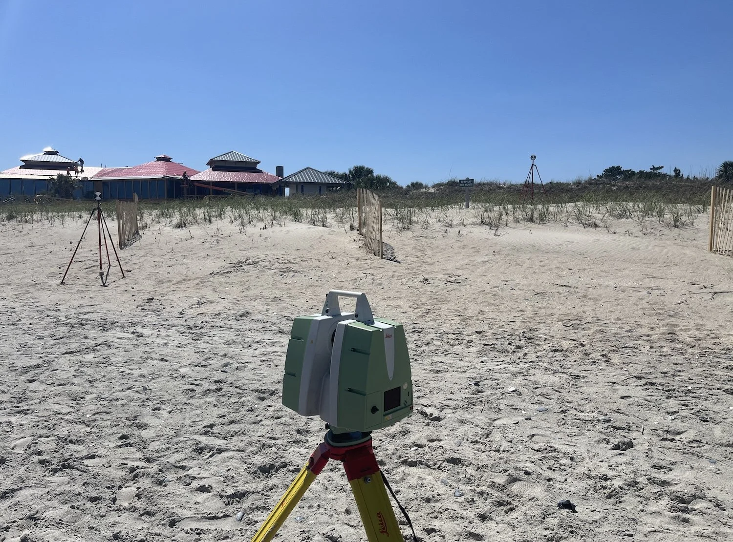
Leica Terrestrial Laser Scanner (TLS) set up and ready to collect topographic data of the dune system. (Courtesy M. Harris)
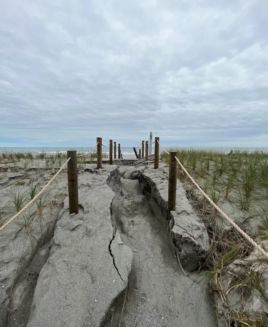
Post-storm erosion on a dune walkover from Hurricane Ian. (Courtesy M. Harris)
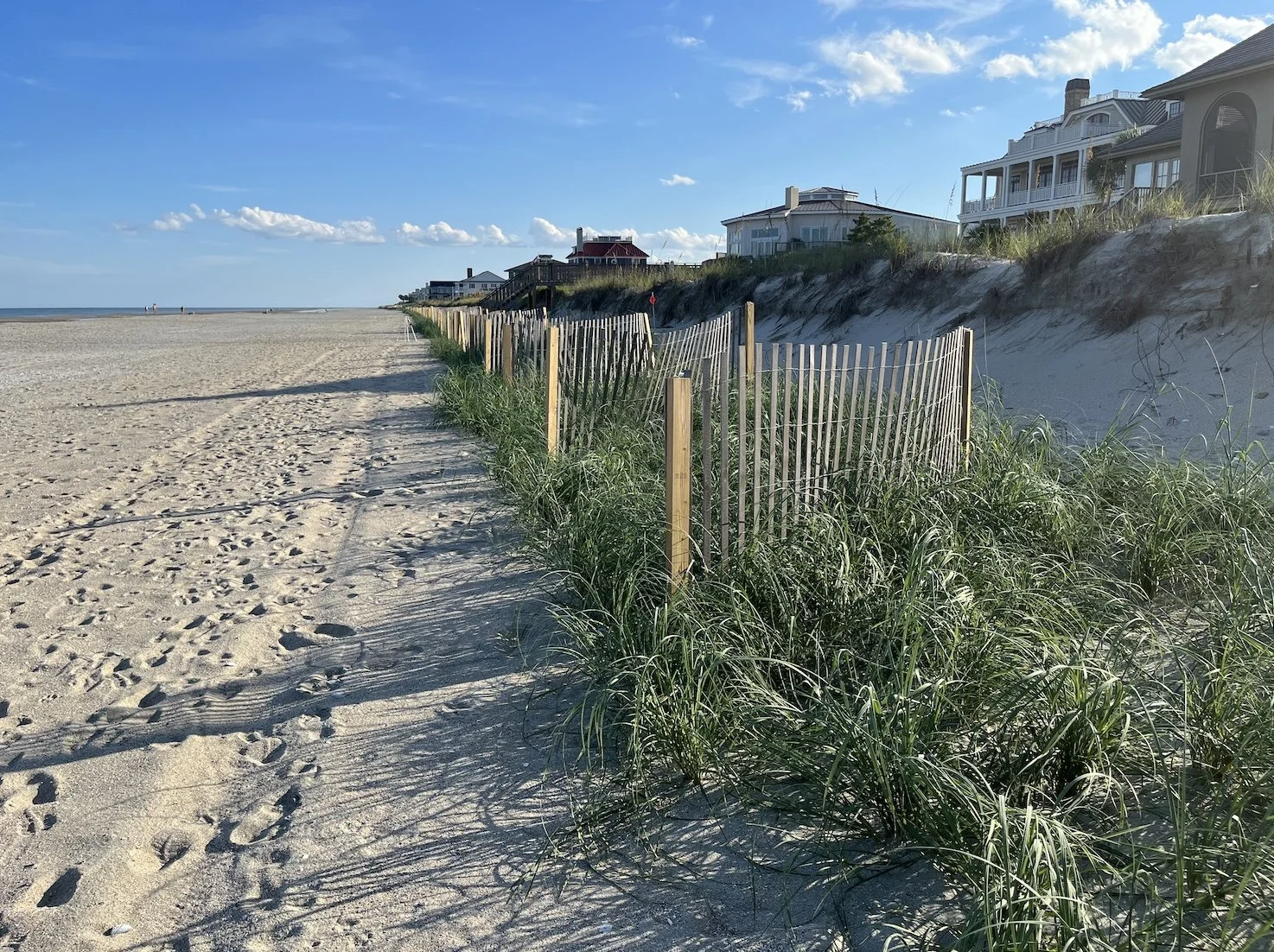
Sand fence installation with vegetation emerging post-storm. (Courtesy M. Harris)
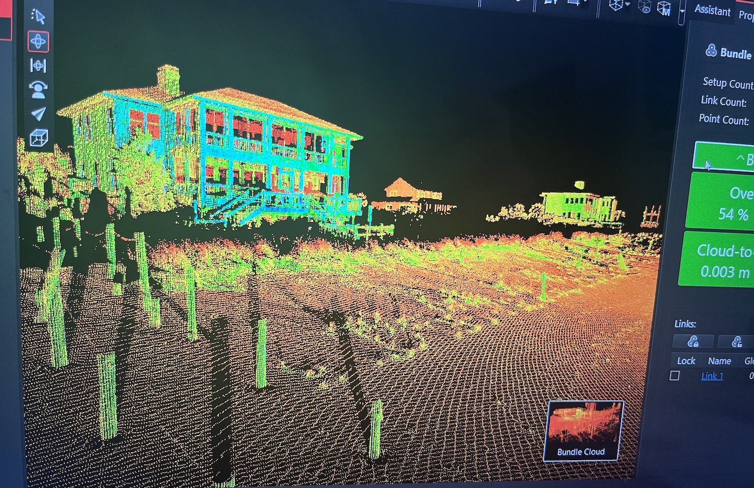
Example of pointcloud registration from TLS data collected in the field, which will be used to calculate dune volume change over time. (Courtesy M. Harris)
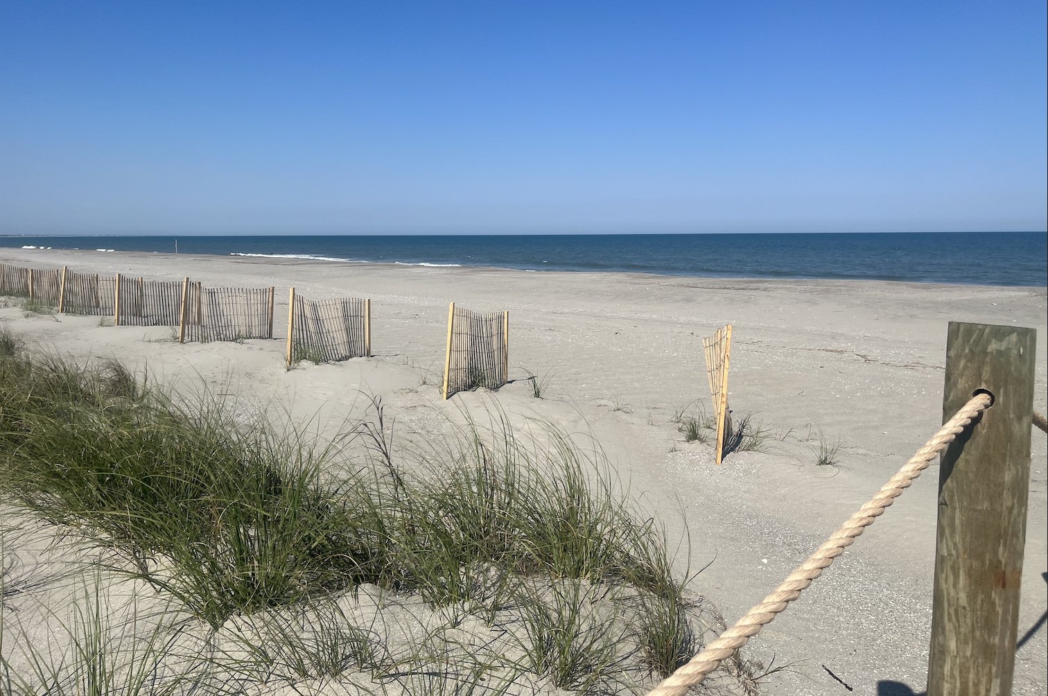
Sand fences and vegetation co-located during height of vegetation growth pre-storm impact. (Courtesy M. Harris)